ETR // Stage 23 // Roskilde - Stege

© ETR // European Touring Route AS
Open this stage on the map

Distance

  • Roskilde - Stege

  • Radius 100 km
  • 164 km

Highlights

  • Lejre Land of Legends
  • Vallø Castle & Park
  • Stevnsfort Cold War Fortress
  • Camp Adventure
  • Gisselfeld Manor
  • Møn UNESCO Biosphere
  • Geocenter Møns Klint
  • Møn's Klint & Forest
  • Dark Sky Møn
  • Liselund Castle Park
  • Liselund Laboratory
  • Danmarks Borgcenter
© ETR // European Touring Route AS

Land of Legends

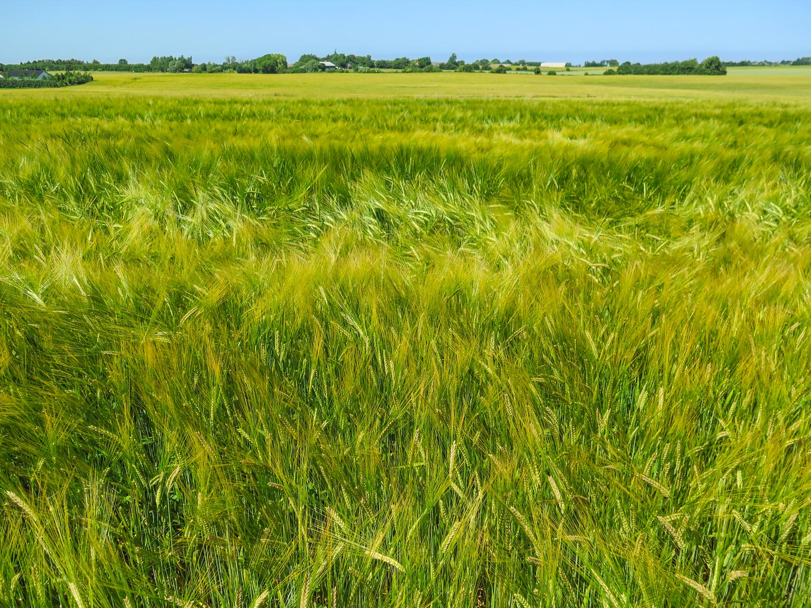
Heading south from Roskilde, you'll ride through Sagnlandet Lejre (Lejre Land of Legends) where you can find houses and environments from the Stone Age, the Iron Age, the Viking Age and the 1800's, as well as textile and pottery workshops. 43 hectars of unique nature with hills, forests, lakes and meadows for you to lose yourself in, and maybe rediscover your own Viking genes.
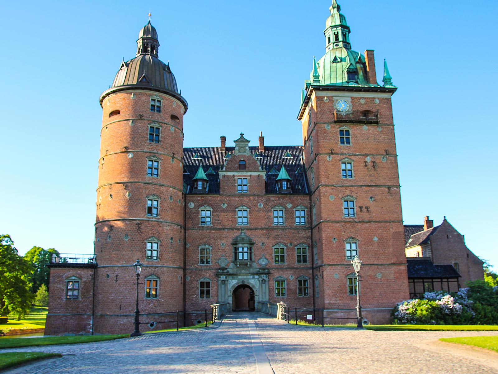
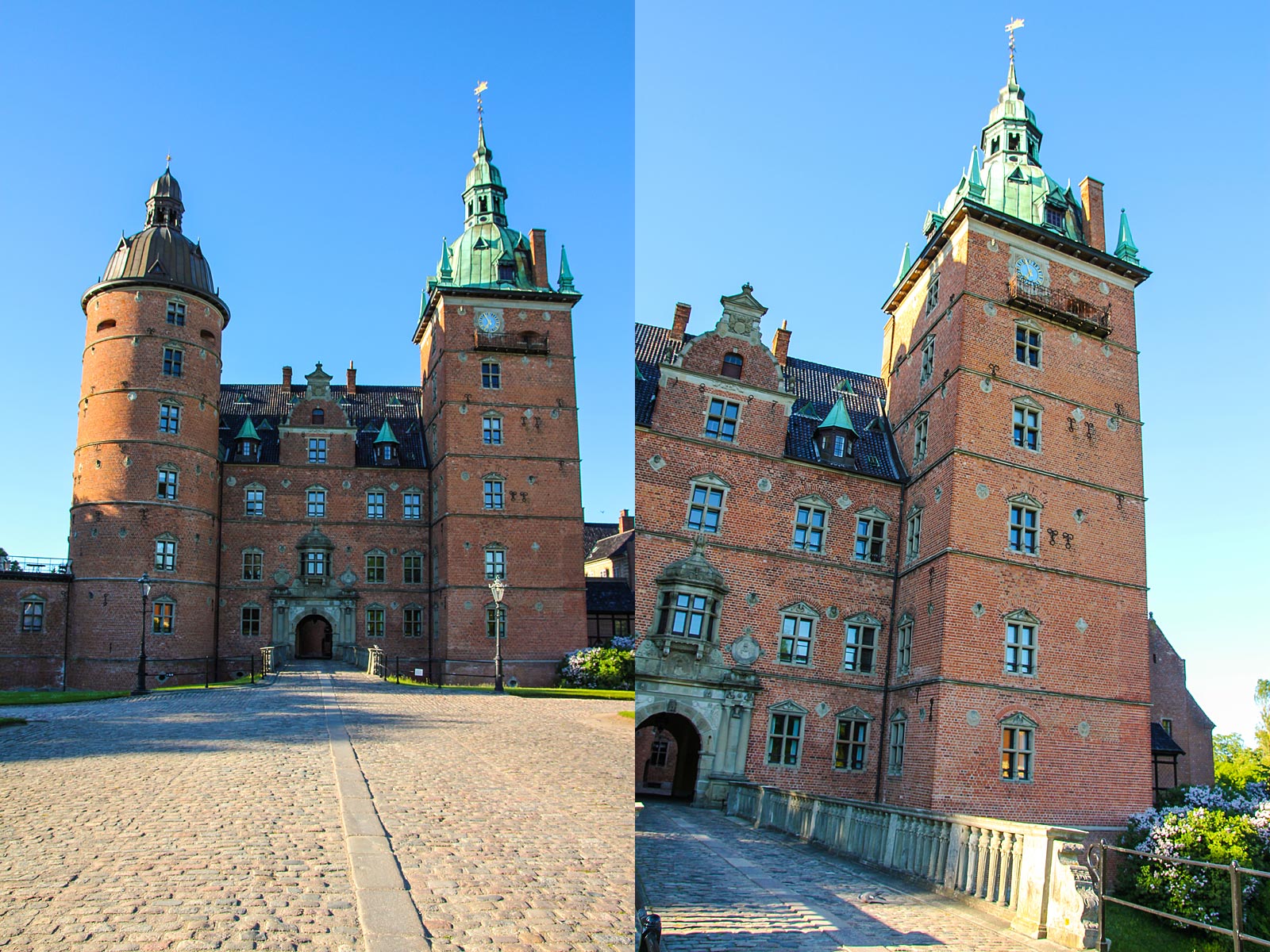
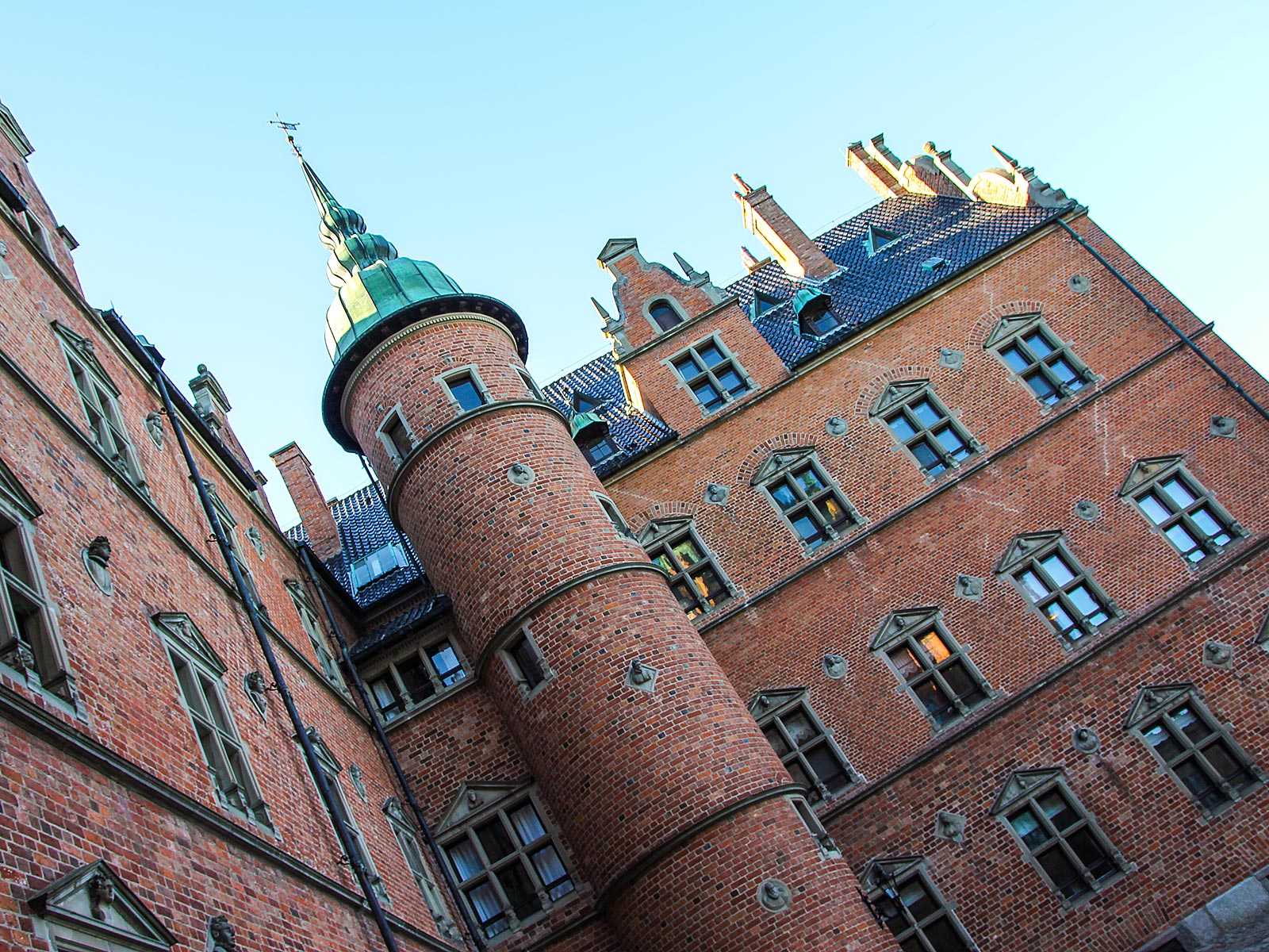
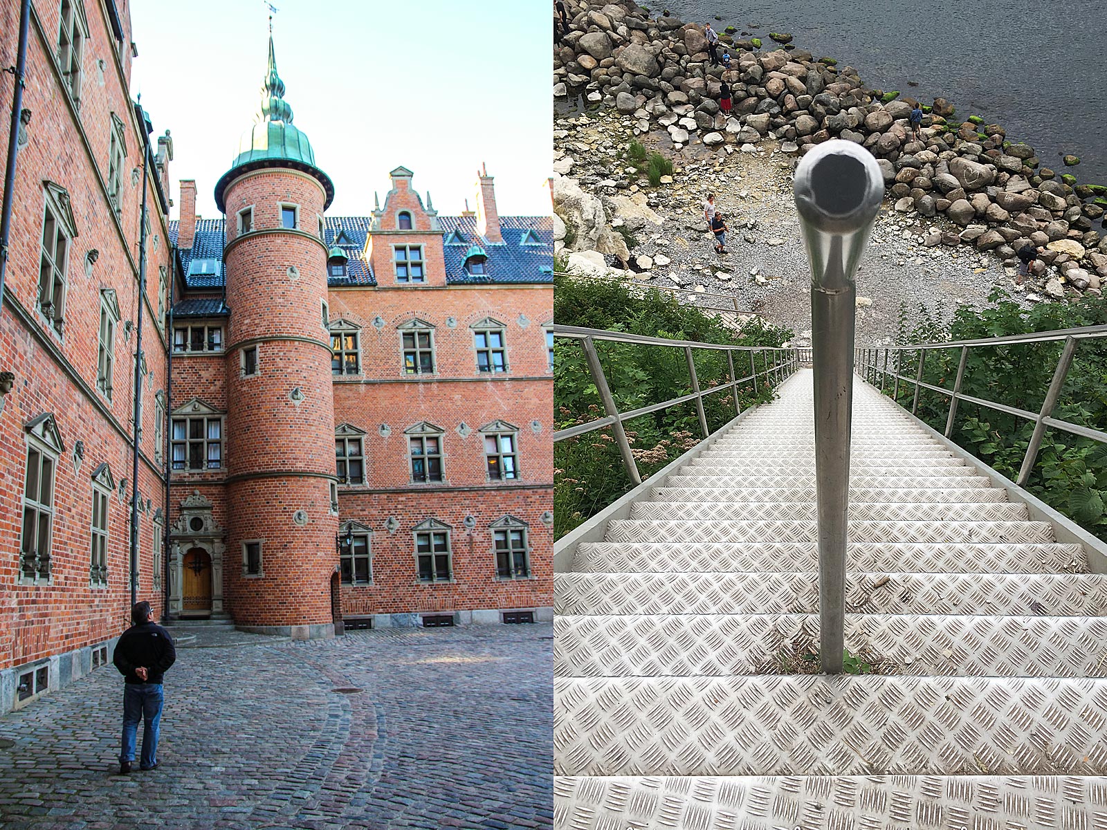
Vallø Castle

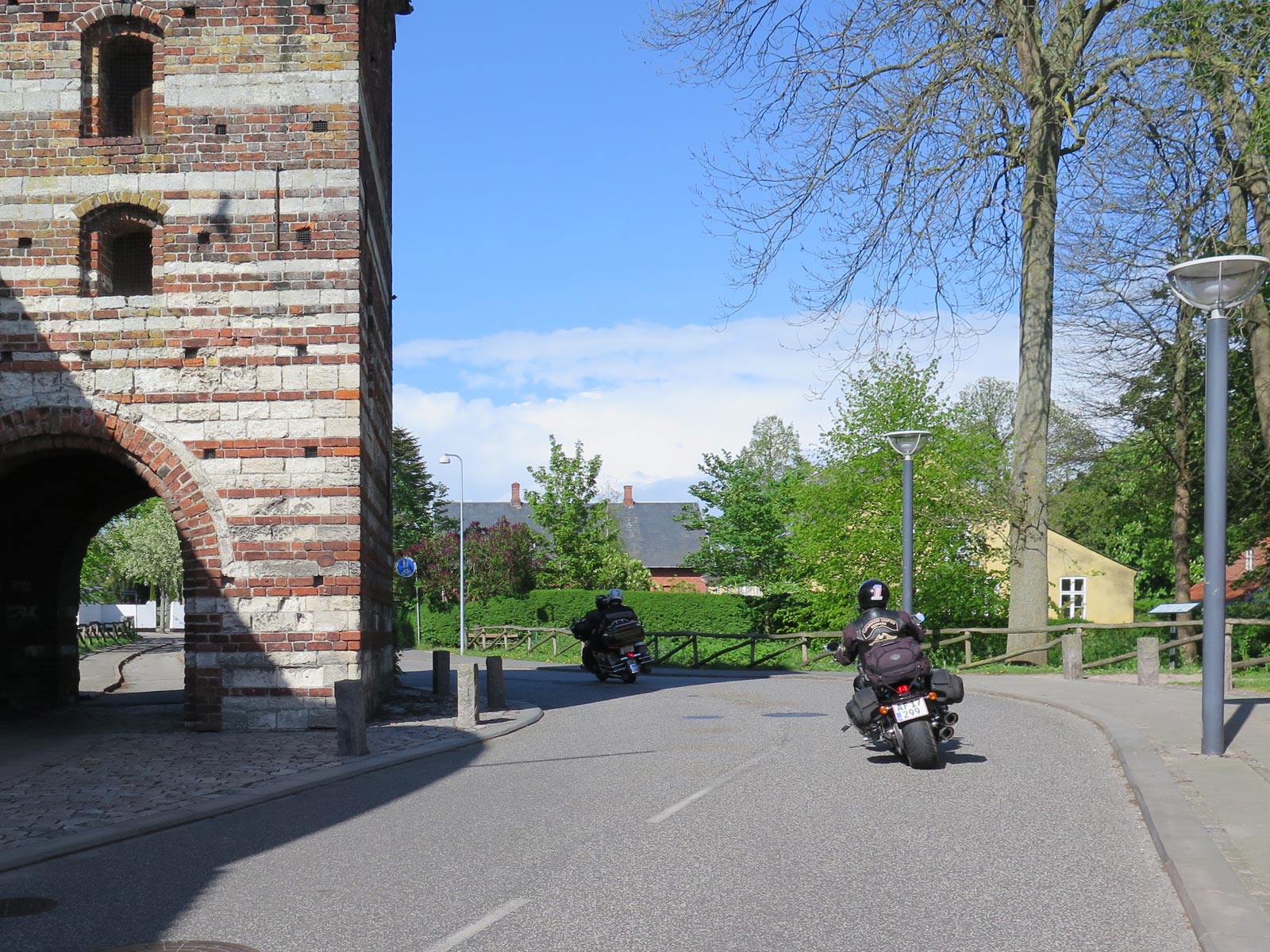
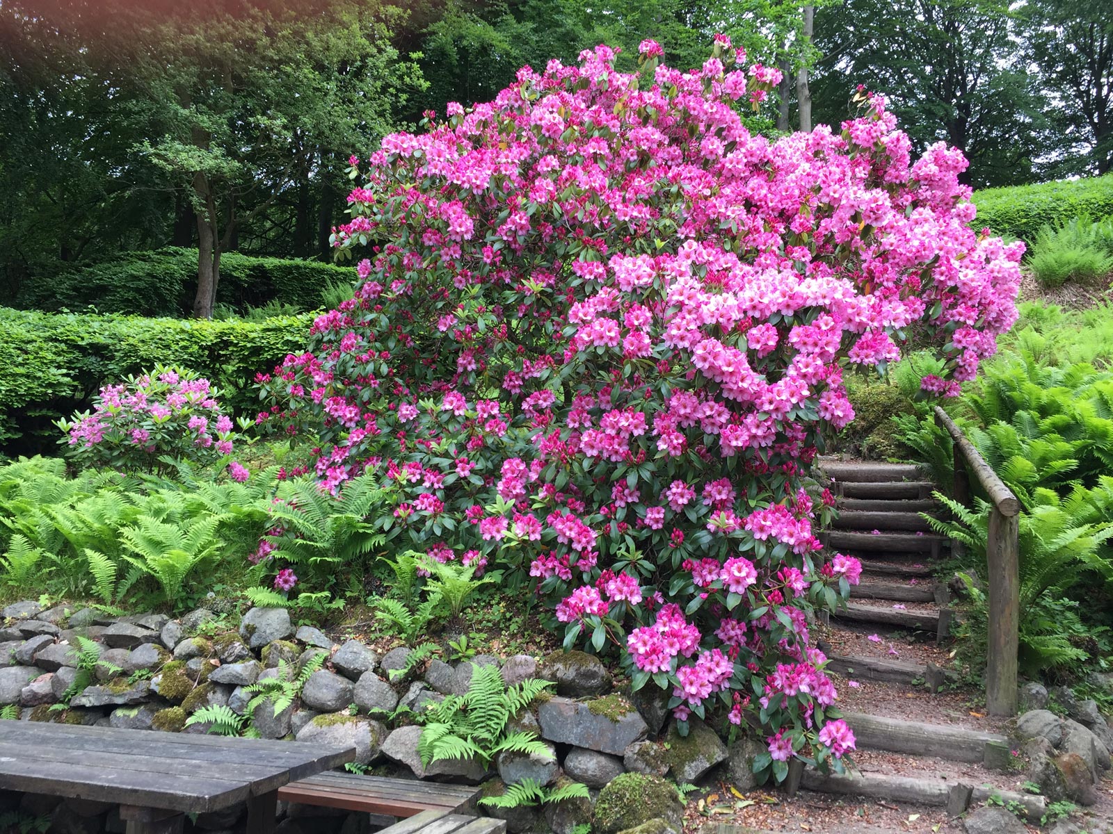
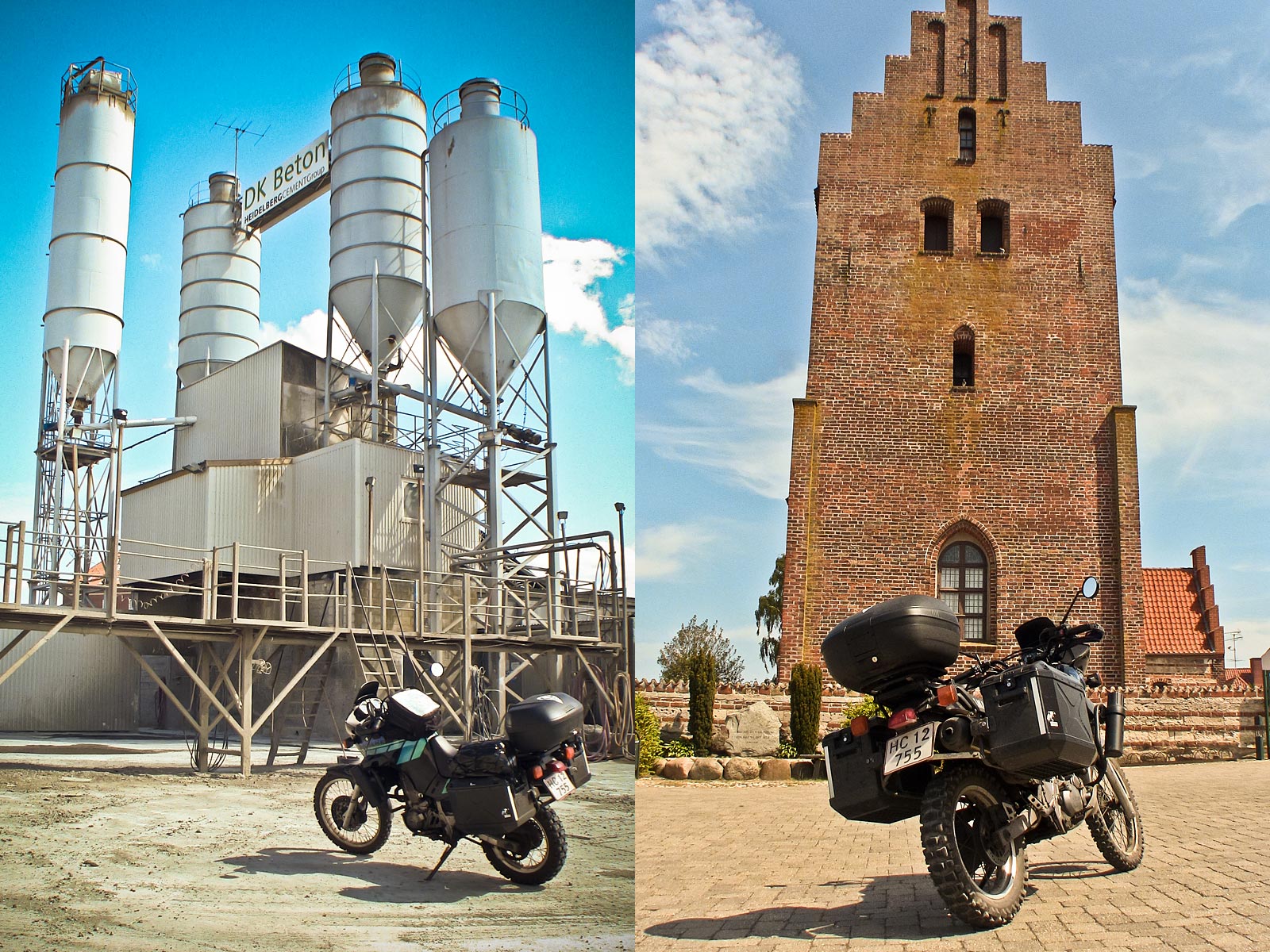
Situated about 7 km south of Køge, Vallø Slot in Stevns can trace its history back to the 14th century. Vallø is surrounded by a moat and is constructed with four wings and imposing towers, and the surrounding park was turned into a Romantic landscape garden in 1830 and retains elements from the former French gardens dating back to the 1720's. Just beside the castle you'll find a cluster of historic houses known as Vallø Slotsgade (Vallø Castle Street).

© ETR // European Touring Route AS

Stevnsfort Cold War Fortress

Later, head over to Stevnsfort Cold War Fortress for an insight into how tense the nuclear situation in the Baltic was back then. For more than four decades, the underground fortress, with it's heavy artillery guns, monitored all Warsaw Pact naval vessels, entering and leaving the Baltic Sea. The fortress was constructed to withstand a nuclear attack, and packed with radar, sonar and hydrophones, it could monitor all movements in the western Baltic, and react instantly in the event of an attack.

Built to withstand a nuclear shockwave

With its 1,7 km of corridors, between 18 to 20 meters below ground, carved into the limestone of Stevns Klint, the underground fortress housed ammunition magazines, an artillery center, engineering centers, residential facilities, a hospital, and a mortuary. If the fortress came under nuclear attack, everything on the surface, within a radius of a couple of hundred kilometers, would be vapourised in the shockwave from a nuclear explosion.

Live each day like it's your last

The soldiers manning this defense post were fully aware that every day they went to work could potentially be their last. There would be no means of escape, in the minutes after they became aware of an impending attack. Instead, they had to remain at their posts and for the chosen few, take the decision whether to launch a counter­ attack, if the threat was real. That's a lot of responsibility to have on your shoulders.

© ETR // European Touring Route AS

The Guns of Gneisenau

The original main battery at Stevnsfortet consisted of 2 armored towers with dual 15cm cannons, and with a range of around 23km, could cover the mouth of the Baltic Sea, all the way over to the Swedish coast. Until 1943, the cannons were in use aboard the German battleship Gneisenau, after which they were installed in the German built battery at 'Grådyb' on Fanø, as part of the Atlantic Wall fortifications on the West coast of Denmark, from where they were moved to Stevnsfortet, in 1953.

Back in The Great Unpleasantness

The underground fortress remained operational right up to the year 2000, when it was decommissioned (though left fully intact) by the Royal Danish Navy, effectively bringing an end the 47 years of service, as a bastion of NATO and Danish defence during the Cold War period. The Cold War began at the end of the Second World War, and lasted until the fall of the Berlin wall 1989, and the eventual collapse of the Soviet Union in 1991. It was an era of great hostility between western and eastern forces, and a continuing state of political and military tension between, on one side, the US and NATO, and on the other side, the USSR and an alliance of other Communist states.

Though never leading to outright nuclear war, it was a time charged with espionage, lies, misinformation, disinformation, double-dealing, propaganda, conventional and nuclear arms races, and diplomatic, military, and economic instability. Given the rampant and widespread nuclear paranoia and extreme caution being excercised on both sides, it's easy to understand the necessity for a facility such as Stevnsfortet. Also in today's climate.

Adrenalin and Serotonin at Camp Adventure

After that, visit Camp Adventure to feel the rush of adrenalin throughout your body. Arriving in Gisselfeld forest you see the 45 meter tower and you get a sense of something you have to experience for the first time. An hour later, you are standing on top of it, looking out over the South Zealand landscape. High above the treetops on the top of the Forest Tower, you can really appreciate the nature of Southern Zealand and the magnificent view. The experience starts already at the old watermill when you first step on the 3,2 kilometer raised footpath, which meanders around the trees and over the streams through the forest, until the tower suddenly appears between the trees. Standing a total of 140 meters above sea level on the viewing platform, you can see all the way to Copenhagen and Malmö more than 50 kilometers away, on a clear day.

© ETR // European Touring Route AS

Photos

  • Dave O'Byrne

  • European Touring Route AS

Partners

© ETR // European Touring Route AS

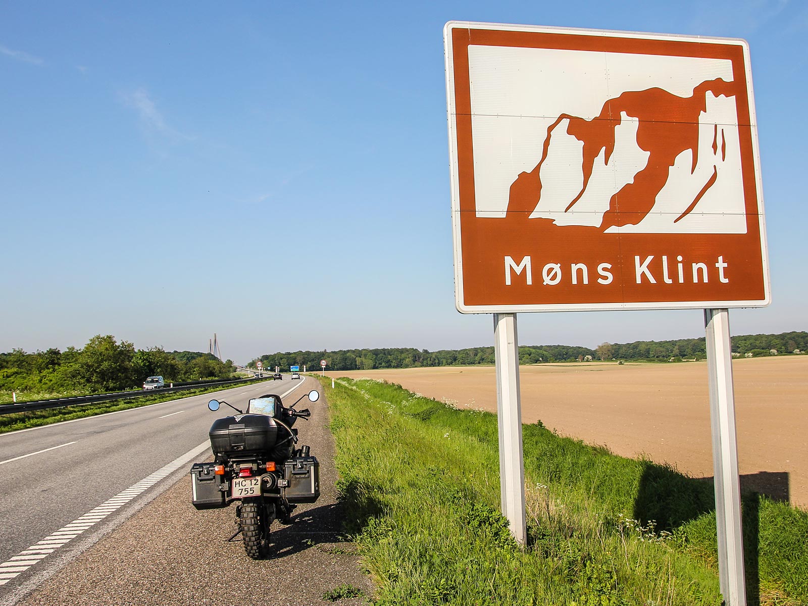
Møn Biosphere and World Heritage Site

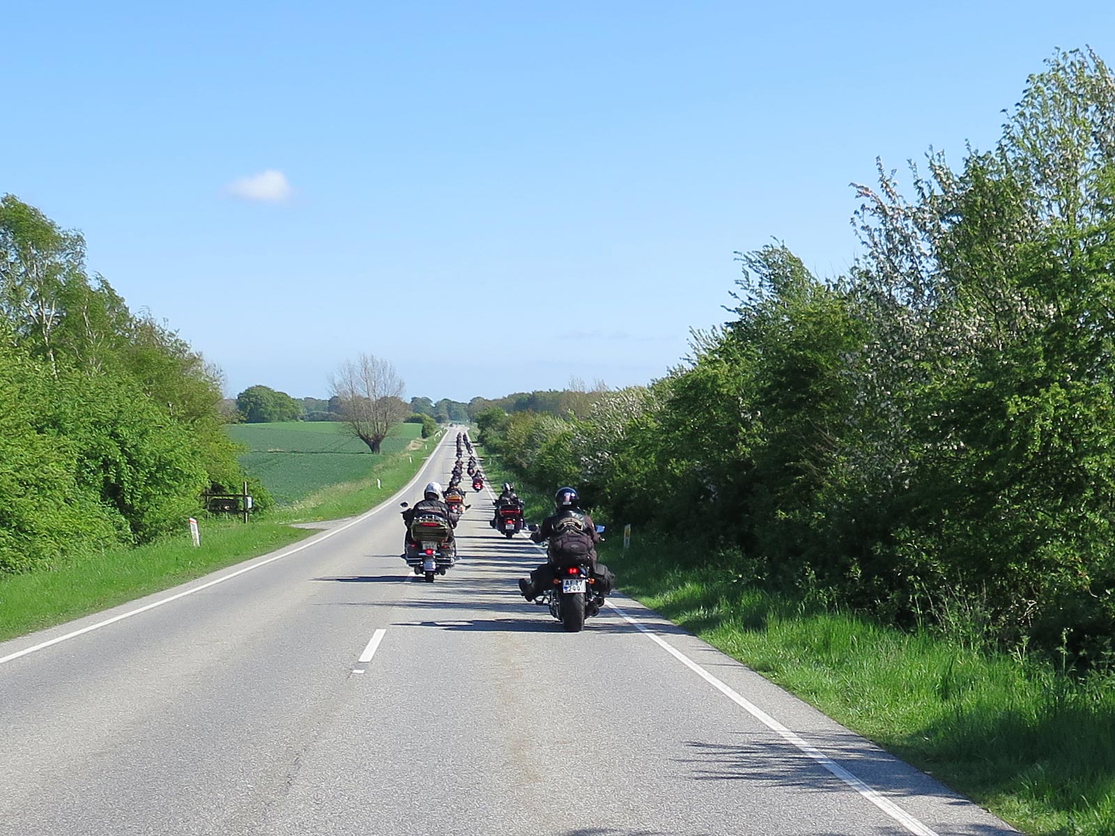
Continue south to the UNESCO Biosphere, World Heritage Site and protected nature reserve that is the beautiful island of Møn.

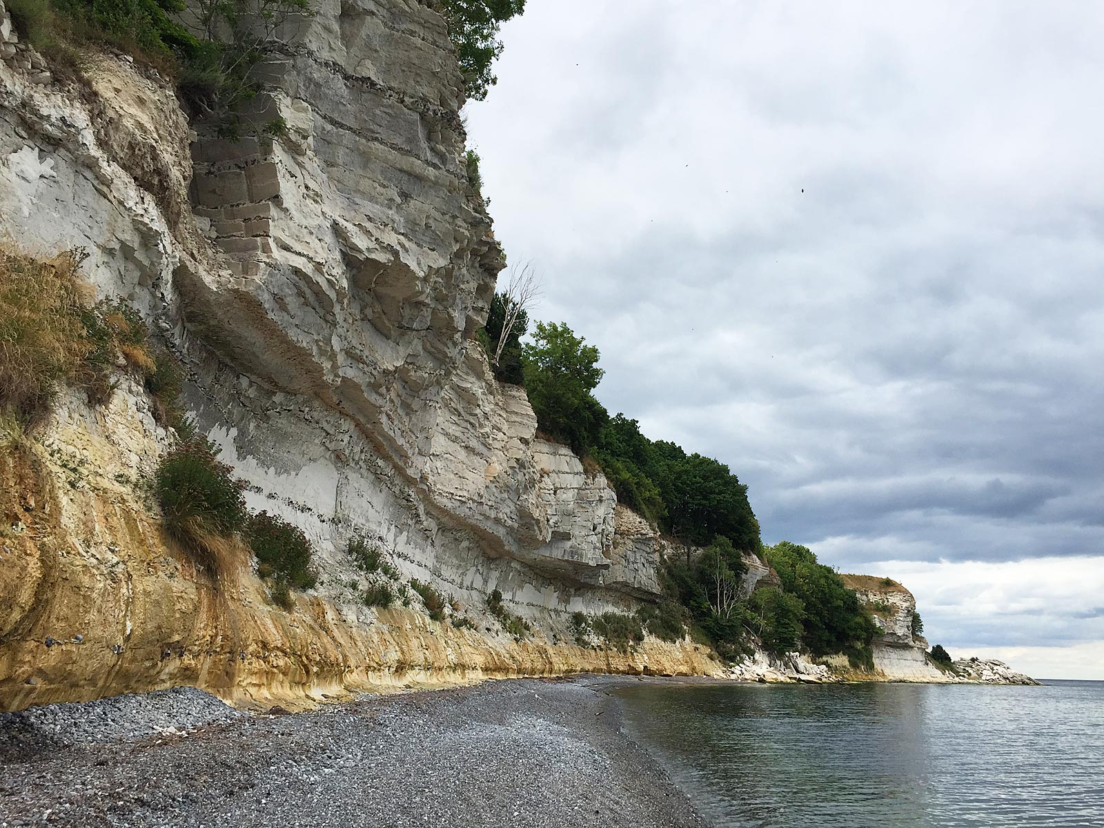
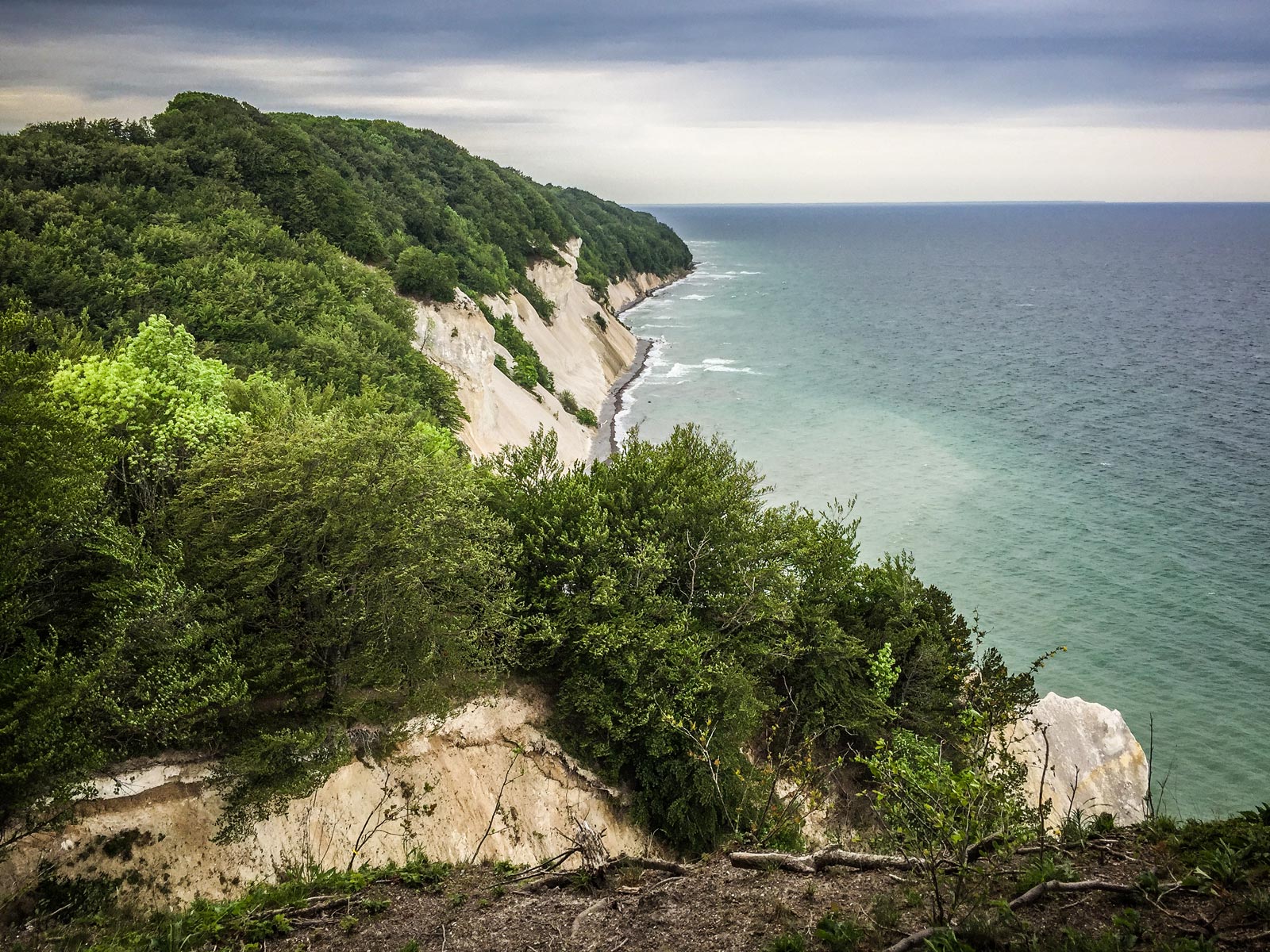
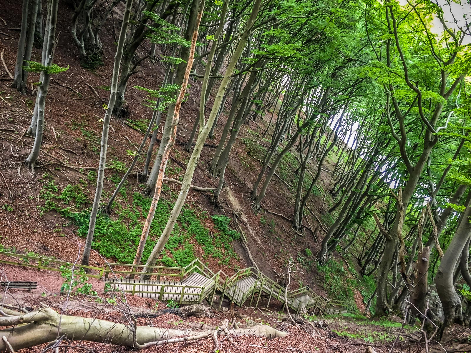
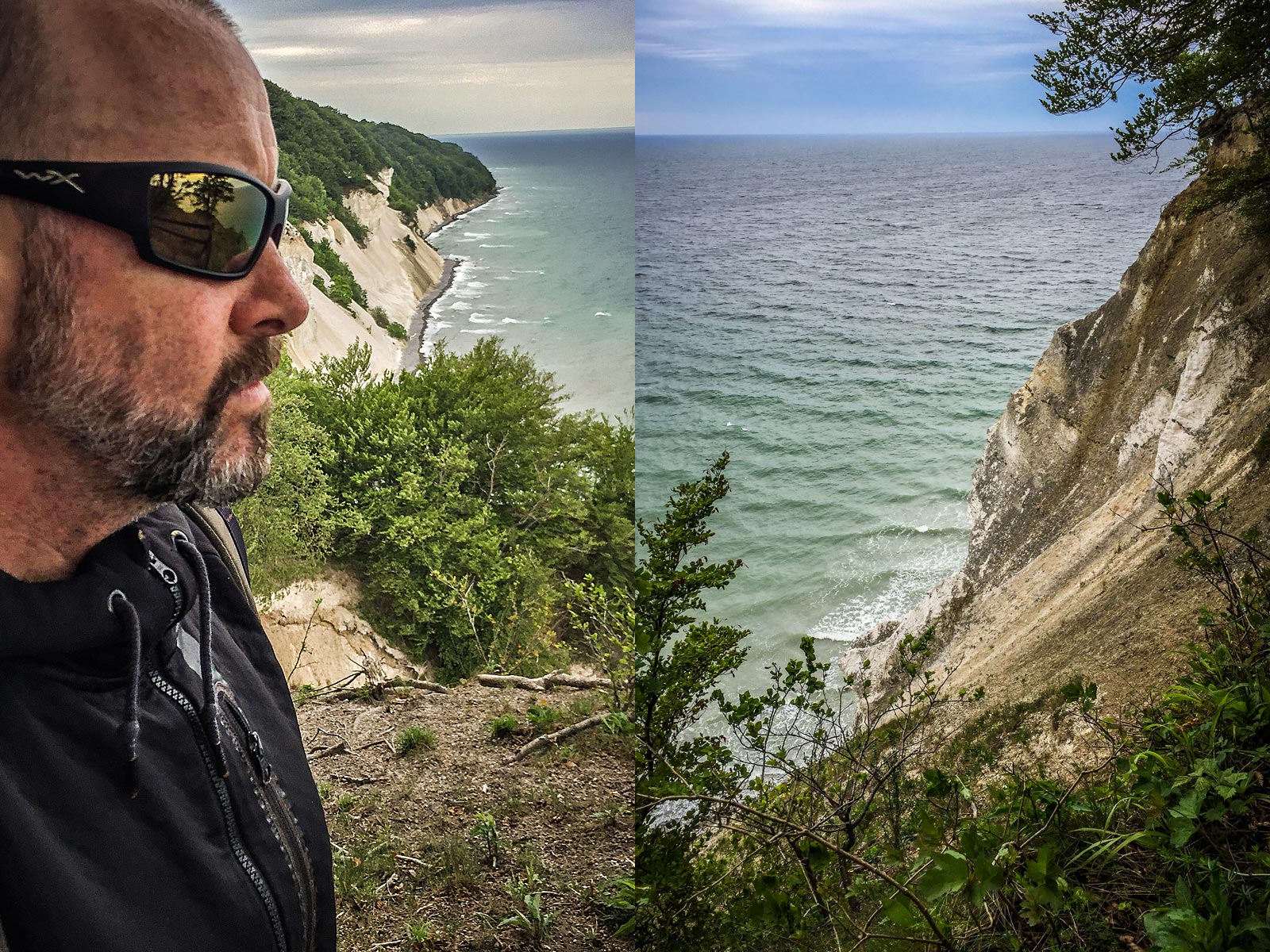
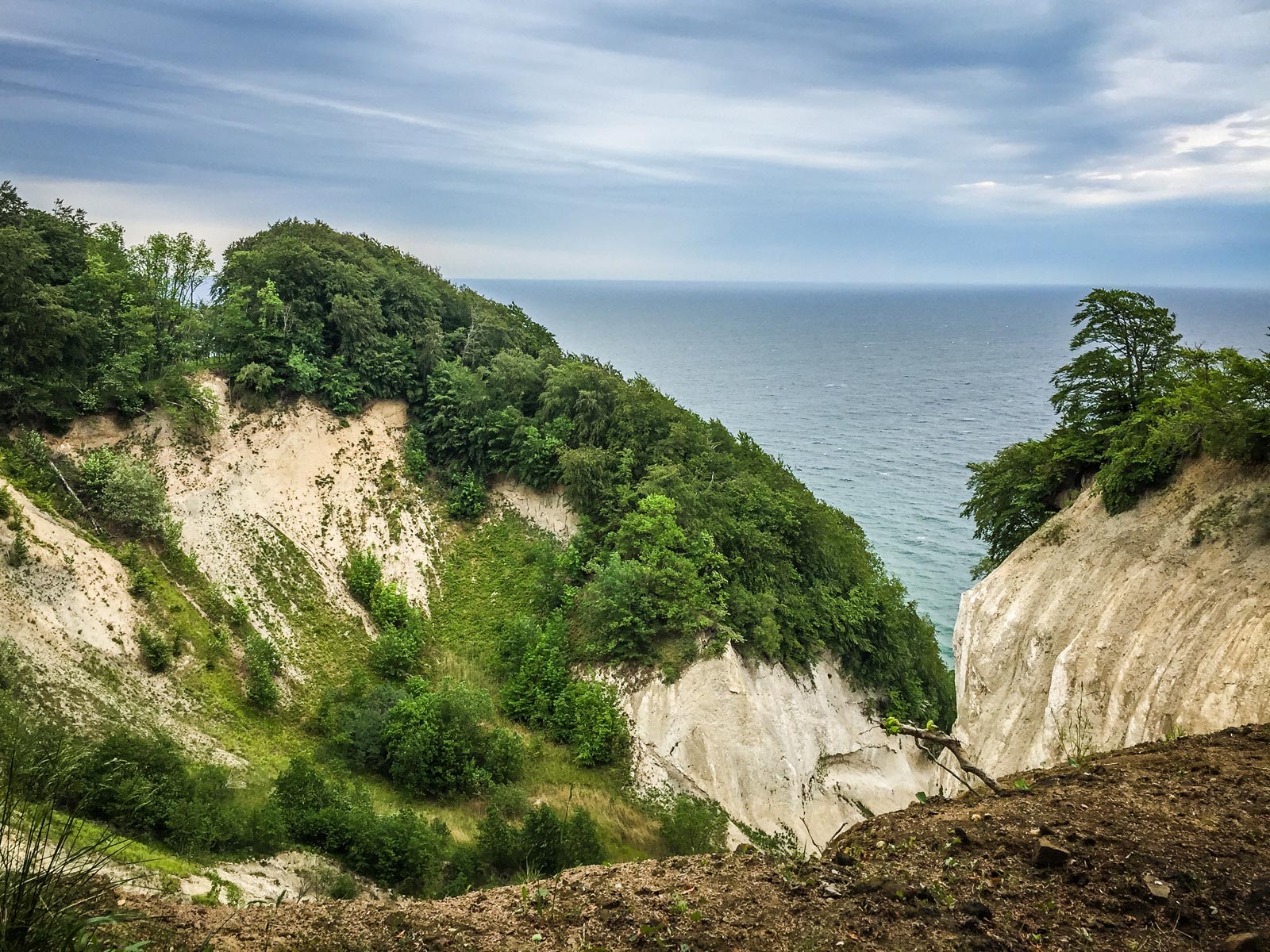
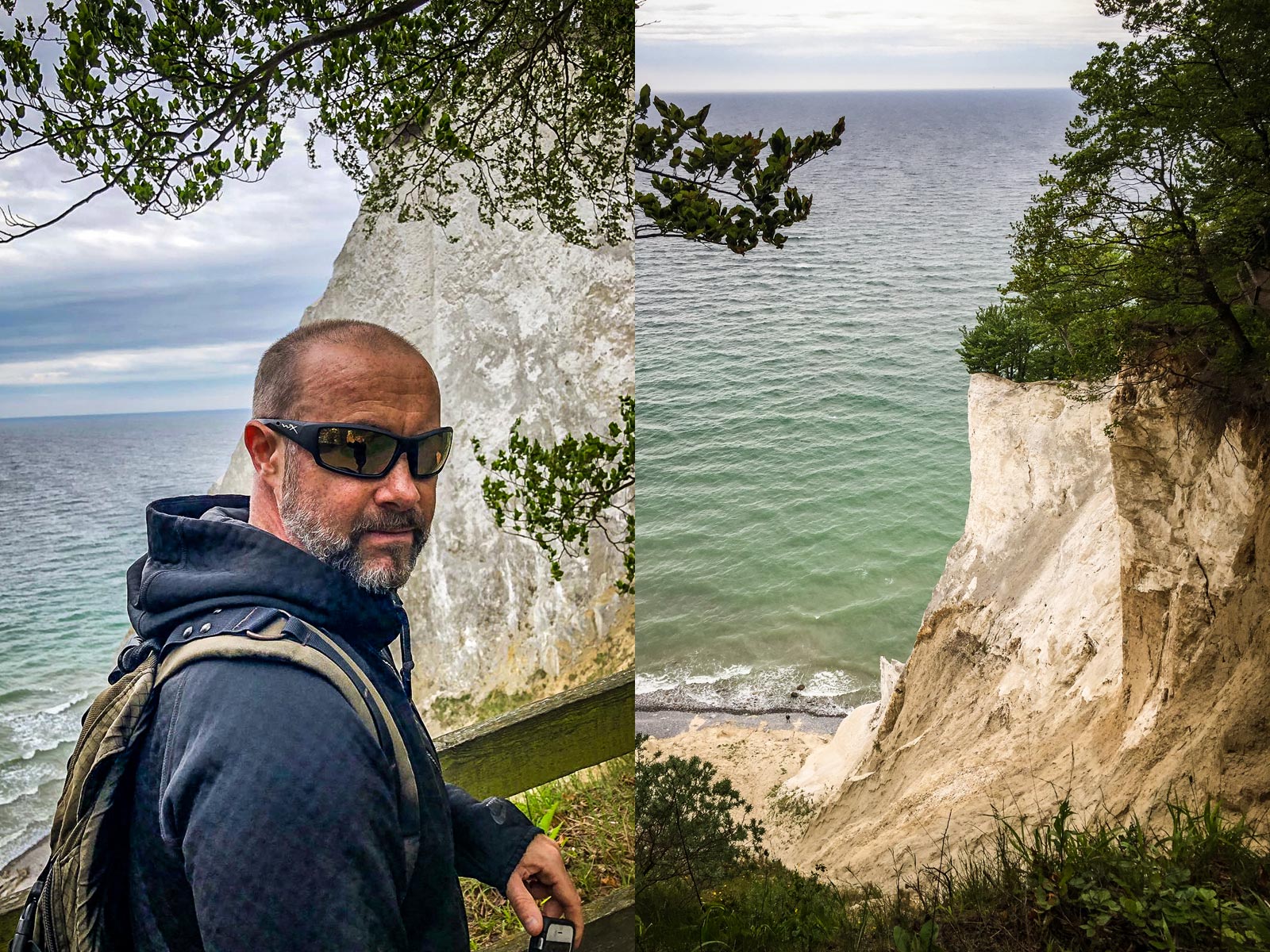
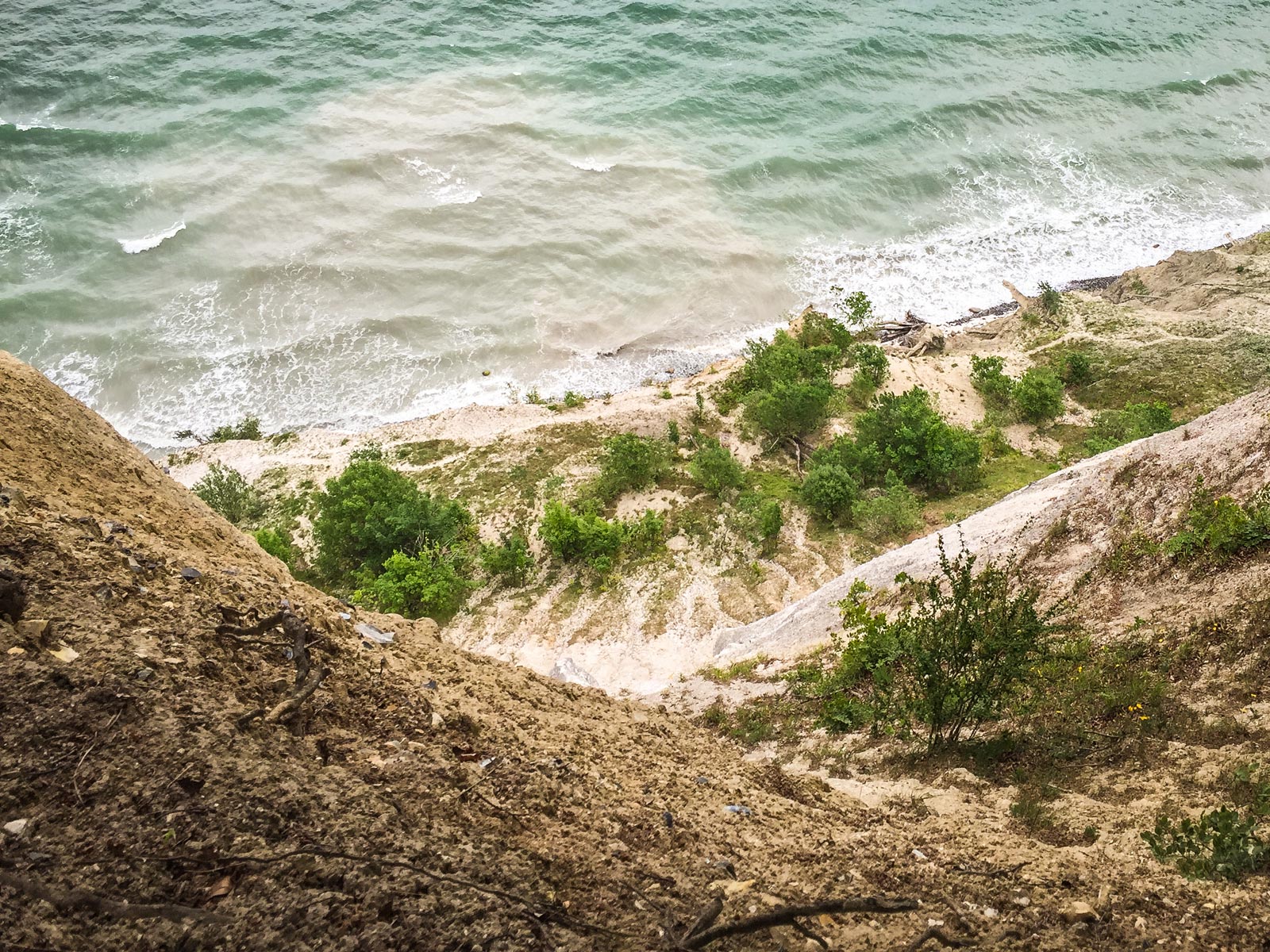
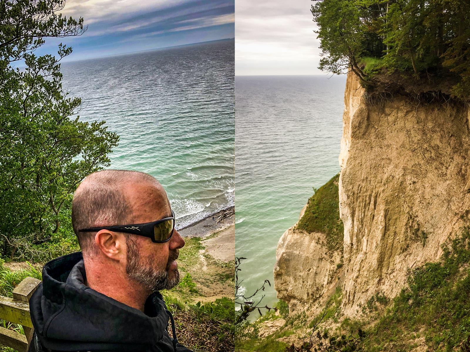
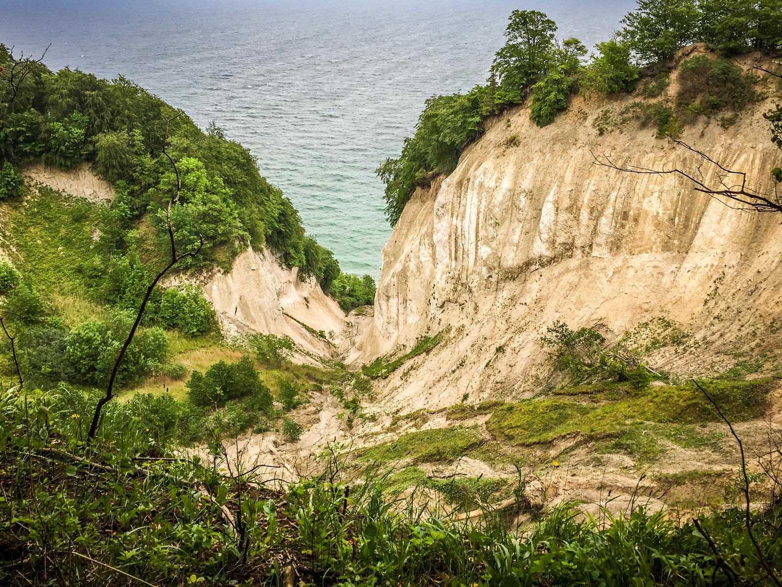
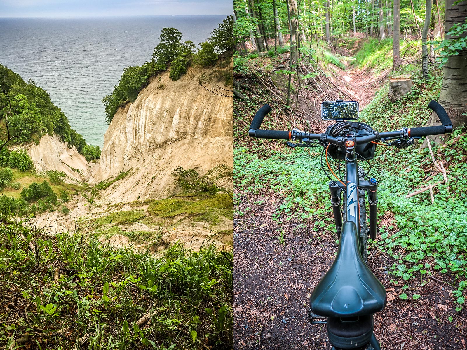
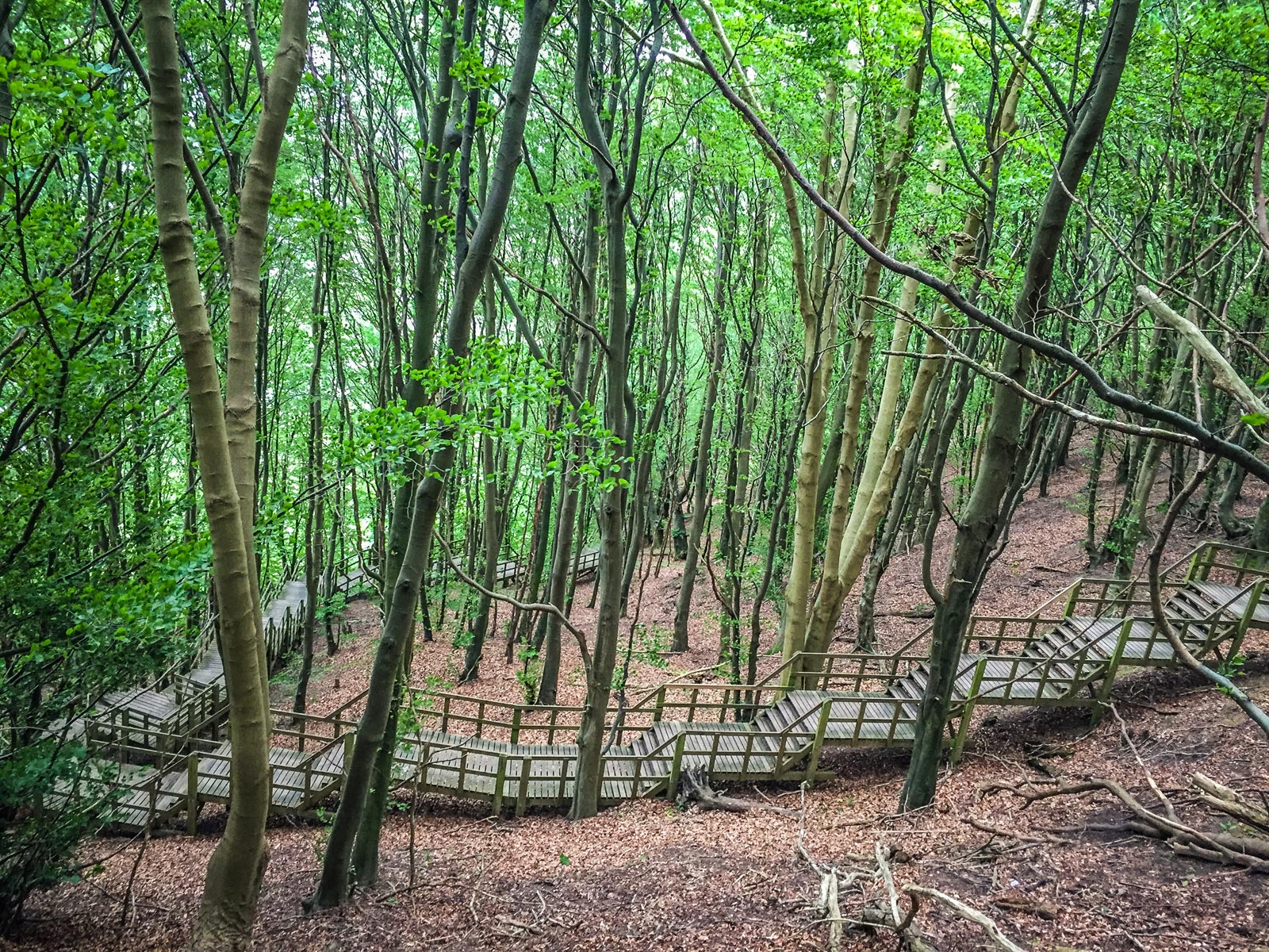
Møns Klint is an impressive landmark along the eastern coast of the island of Møn. The bright chalk cliffs stretch some 6 km from the park of Liselund in the north to the lighthouse in the south. Some of the cliffs fall a sheer 120 meters to Baltic Sea below. The cliffs and adjacent park are now protected as a nature reserve and consist of woodlands, pastures, ponds, lakes, steep hills with good walking trails. It's also a great mountain biking destination.

Møns Klint is popular with tourists from across Europe with hundreds of thousands of visitors a year, and a lot of them arrive on motorbikes. The path along the cliff tops provides impressive views and leads to steps down to the shore in several locations. On a clear day you can see Germany, Poland and Sweden from the top. Maybe even Kaliningrad, which is only 460 kilometeres across The Baltic to the east.

© ETR // European Touring Route AS

International Dark Sky Certification

The island of Møn has also attained International Dark Sky status, where you can gaze far out into deep space on a clear night. Far out. Protected from local light pollution, Aborrebjerget (143m) is a good place to get a 360-degree view of the galaxies at night, where millions of stars shimmer above you, and you have the clearest view of the starry sky in the Baltic Region. With a height of 143 m, it is one of the highest points in Denmark.

Liselund Laboratory Møn

Experience a new artistic experience every month for a year in Liselund Garden Park, where artists and scientists rethink the relationship between nature and humans.

On Møn you can find some of Denmark's most beautiful and best-preserved stone dolmens and burial chambers, several of which are more than 5,000 years old. You can still get really close and actually crawl all the way into the burial chamber - if that's your thing..

ETR 60 Stages

© ETR.world. ETR.travel. ETR XR. All rights reserved. EU Copyright | GDPR | SDG's | Cookies | Terms | Credits